"Building a New Trail to a Beautiful Ledge" (
pictures)
(
Map/Directions/Trail Descriptions)
Late Saturday Scott and I decided we would take a drive up to Moose Mountains for a small hike and to check on the property we steward. When we arrived we pondered on what to hike. We decided on looking for the ledge I had been wanting to search for so bad. I first saw this ledge from the shore of Bowser Pond. When I looked on the Google satellite map I could see this ledge and I wondered how far from the North Road trail it was and I wondered what the view was like from it. Once again we saw this collection of massive ledges from the new trail we were plotting out on Phoebes Nable Mt. So it was time we found out if it was as grand a ledge as it looked!

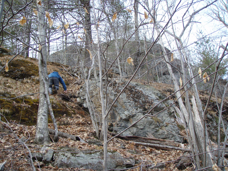
I had studied the trail maps and satellite map pretty well and I determined a starting point to enter the woods. It is across from a small clearing off of North (road) Trail past the junction with Phoebes Nable Mt. trail. I determined a Northerly direction would place us right at the base of the ledge. So we entered the woods here and found a small ridge we were able to follow, as well as a rock wall down the hill to our right. The bushwhack was surprisingly easy. Steep, but the woods were fairly open enough for easy walking. The trees thickened as the ridge leveled off and we soon could see rock boulders and ledges through the woods ahead!

The ledges were massive and the terrain around them very steep. The jagged, lichen and grass covered rock all around was beautiful. We spotted a split area where we could make a steep climb. Our climb payed off. As we walked out onto the ledge we were treated to a spectacular 180 degree view. We had searched so many trails on the reservation in search of a great view and finally found it!
We could look down onto the woods and mountains that Piper Mt. Road runs through, with Piper Mt. on straight ahead. We could see Bowser Pond frozen in ice and the heron rookery behind it. Phoebes Nable mountain was visible as was the logging/skid roads that we had walked and plan to build trails on. Beyond, the Blue Hills Range was seen including Nubble Mt. in Farmington, Blue Job and Prospect Mt. It was such a lovely, peaceful spot!
Deer and Moose also seemed to like the area as their droppings were plentiful in the area. We made our way up to the top of the hill where it forms a small wooded knob area of rock and vegetation. We decided to name it Beauty Knob and Beauty Ledge. The elevation at the highest point of the knob according to the GPS was 1,238 feet. We were so thrilled with this find, we vowed to return the next day to begin building a trail to it! After exploring two other ledge tops, both with a limited view in one direction, we headed back down.
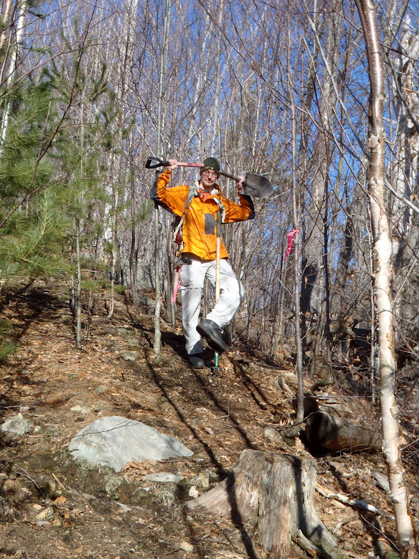
Next day we were both up and ready to go nice and early. We gathered together food, tools and our bags and headed out to complete our mission. We drove up and parked at the clearing at 9:30am. To start we determined where the trail head should be. There was a nice clump of rocks that would be nice to put a trail along, so we decided to start the trail here where there was also a nice birch tree we could affix a trail sign too when the time comes.
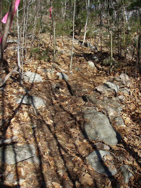
Scott took tree cutting duty and began cutting with the clippers. I got stump/rock removal & raking duties. First I headed through the woods with my pink marker tape to mark-out a good trail route. The plan was to bring the trail through the easiest to "clean" sections and by any interesting features.
The job was difficult. It took a lot of cutting, digging stumps and rocks out, raking away the leaves, sticks and loose rock from the trail. But it was a beautiful February day with mild temperatures and a brisk breeze that kept things comfortable all day. We worked well together as we worked our way around boulders, along a rock wall and through a steep pine glade. At about 12:30 we were getting tired and needed to eat some lunch. So we decided to hike to the ledge to eat.
On the way up we discovered a large rock that resembled an animal. "Snapping Turtle Rock" we named it. The hike up the ledge was difficult. Lunch bags in hand and steep, icy climbing wasn't easy! As we negotiated the rocks and steep bankings we searched for a path that would be easiest to put a trail. We finally decided it best to keep the trail below the steep, rocky area and follow the boulders below around to the back of the ledge.
We finally worked our way up to the ledge and enjoyed our food and the glorious view we were working hard to build a trail to, so that others could also enjoy this view. After eating we explored and tried to figure out the best way to get over or around these massive ledges. We got back around to Snapping Turtle Rock and decided this is as far as we would cut to today until we could mark a good route to the top of the ledge.

We began our work again and kept at it until we reached the rock. We were just about spent on energy and ready to call it a day. We accomplished a lot! We cleared out the trail and did a really nice job. No injuries aside from a few whips in the face from branches, sore bodies and hands and a broken shovel...oops! The trail will need some touch-ups but is ready to go for hiking. Once we finish up to the ledge we can blaze it and get the map updated! Looks like we will be back at it next weekend if this awesome weather continues. I mean really...trail building in February....c'mon! How often can that be done!Check some before and after photos below!


Great job guys!
ReplyDeletejust checked the trail out a few days ago. super view! nice work guys. peace
ReplyDeleteThanks all :)
ReplyDelete