Photo Gallery

Photo Gallery
Showing posts with label spnhf. Show all posts
Showing posts with label spnhf. Show all posts
Sunday, March 10, 2013

Wednesday, February 8, 2012
MMR Map/Directions/Trail Descriptions
- Visit the Forest Society's website for more info. and the updated map -
Moose Mountains Reservation in Middleton and Brookfield, NH covers roughly 2,500 acres and in conjunction with town land, Ellis Hatch and Copple Crown conservation areas it is one of the largest non-developed forests in Southern New Hampshire! It is a crucial tract of land, harboring important headwaters of the Salmon Falls River.
The forests and hills contain a host of native wildlife such as black bear, moose, porcupine, coyote and a heron rookery. As well as a plentiful array of wildflowers including some rare orchids, wild columbine, rock harlequin, sundew's and wild berries. Hiking, bird watching, fishing, hunting, cross-country skiing, snowmobiling and other low impact outdoor recreation can be enjoyed on the property. Hiking trails are a combined woods roads and foot paths taking you to several ponds and marshes, open summit peaks and ledges, early 1800's cemeteries and old farmland. There is plenty to explore here!
The main trails are signed and blazed and we continue to work on getting the less traveled trails cleared out and marked as well.
DIRECTIONS TO MAIN PARKING/KIOSK: directions obtained from Google Maps
* Please drive carefully along the narrow road and watch for other drivers and residents.
* Currently there may not be winter parking access and parking is not permitted along the road or at the parking lot entrance.
From NH Rt. 16 Spaulding Turnpike (Portsmouth/Rochester/Milton/White Mountains)
About 3.3 miles from Rt. 16 in Milton, NH
-From Rt. 16 Spaulding Turnpike in Milton turn onto NH 125/153 South (Main St.)
-Take the 2nd right onto NH 153 South (Middleton Hill Rd.)
-Take the 1st right onto Ridge Rd.
-Take the 2nd right onto New Portsmouth Rd. (sharp corner w/ cemetery on a hill)
-Follow this road to it's end at a small parking area and kiosk.
From NH Rt. 28 (Wolfeboro)
About 11.2 miles from Rt. 28 in Wolfeboro, NH
-From NH Rt. 28 (South Main St.) in Wolfeboro turn onto Kings Highway (Middleton Rd.) at the sharp corner.
-Follow for almost 7 miles and turn left onto Ridge Rd. at the Town Offices
-After about 1.6 miles turn left onto New Portsmouth Rd. (sharp corner w/ cemetery on a hill)
-Follow this road to it's end at a small parking area and kiosk.
From NH Rt. 11 (Concord/Laconia/Alton/New Durham/Farmington)
About 10.2 miles from Rt.11 in Farmington, NH
-From NH Rt. 11 in Farmington turn onto NH 75 East (Central St.)
-Turn left onto NH 153 North (Charles St./Kings Highway)
-Follow for nearly 6 miles and turn right onto Ridge Rd. at the Town Offices
-After about 1.6 miles turn left onto New Portsmouth Rd. (sharp corner w/ cemetery on a hill)
-Follow this road to it's end at a small parking area and kiosk.
TRAIL DESCRIPTIONS:
<GREEN – Easy and Moderate grades> <BLUE – Moderate some steep/loose footing> <RED – Difficult with steep/loose footing>
PHOEBES NABLE MT. LOOP ~ 2.2 MILES ~ 550' ELEVATION GAIN:
- via Phoebes Nable Mt. trail, Phoebes Nable Loop trail and Burrows Farm trail
BEAUTY LEDGE LOOP ~ 3 MILES ~ 600' ELEVATION GAIN:
- via Burrows Farm trail, North trail, Beauty Ledge trail, Beauty Knob tr, North tr, Burrows Farm tr
Phoebes Nable Mt. Trail ~ .6 MILES ~ 550' ELEVATION GAIN: Starting at the kiosk climb moderately using several logging roads and making several steep climbs. The trail begins at the bottom of the parking lot over rock stepping stones. Follow the path for 70 yards and bear left onto a woods road. Continue for another 100 yards climbing stone steps and at .1 miles take a sharp right onto another woods road. Climb a steep hill with restricted views behind you. The trail levels out and then climbs again. At .3 miles turn left and again climb steeply along a skid road. Ferns grow plentiful along this section and as the trail levels out the woods begin to open up around you. The trail hugs a patch of pine trees and makes a sharp right onto a foot path, curving left and then right again as you make the final push to the summit. A view will open up on the left and at .6 miles the spur trail leads 25 yards to the summit of Phoebes Nable Mt. 1,178'. There is a 180* view down to the valley below across several marshes and ponds and out to the Teneriffe range and into Maine. Panning right you look over to the Blue Hills range. From here you can make a loop via Loop trail and Burrows Farm trail.
Burrows Farm Trail ~ 1.1 MILES: From the parking lot Kiosk this trail is the heart of the trail system connecting you to all of MMR's scenic points. Begin at the green gate along a woods road that runs parralell to a brook just through the trees. At .2 miles on the left is the Hall Spring. At .3 miles you cross a bridge over the brook and bear left away from North trail to the right. Climb gradually and cross over the brook again. At .8 miles turn left at the Moose Mountains trail junction, crossing the brook once again and past another green gate. Make a short climb and at .9 miles you enter out to an open field. To the left down the hill is the Steven's Cemetery. Just ahead and to the right you can make a short climb to the Burrows Farm home site. A large rock with a plaque sits here. Continuing on the main trail pass the Burrows Cemetery on the left and near the top of the field bear left at the sign post. There are views across the field to the long ridge which once was sheep pasture hence the name Bald Mt. Cross the field and enter the woods where at 1.1 miles the Burrows Farm trail ends at the Phoebes Nable Loop trail.
Phoebes Nable Loop Trail ~ .5 MILES
1.6 MILES ~ 550' ELEVATION GAIN (from parking lot via Burrows Farm trail): This newly constructed (2015) trail begins at the end of Burrows Farm trail, just as you enter the woods from the field. The trail begins almost level until you come to the first switch-back. At the top of the switch-back you climb slightly and pass along a couple rock boulders. You then pass alongside a ledge and gently climb to the second switch-back which passes through a pine glade. The trail enters back into hard-wood than descends slightly again through pine forest before climbing to a stone staircase built by volunteers. From here you make the final climb slightly right past more ledges and take a sharp left onto the old woods road (lower portion no longer maintained). The summit of Phoebes Nable Mt. is reached in 150 feet.
Bowser Pond Trail: Beginning on New Portsmouth Rd. a few hundred feet below the kiosk this woods road climbs moderately before leveling off (blue blazes). Bear right shortly past this and follow the unmarked road (Private Property – stay on trail) to the shore of Bowser Pond with excellent views up to Beauty Ledge. Back on the main trail continue along level ground passing a short path on the right to the West shore of the pond and soon ending at Piper Mt. Trail.
North Trail: Beginning off of Burrows Farm trail past the river crossing this logging road serves as a connection to the trails on the East side of the Reservation. Grades are moderate and offer various restricted views along the way. The trail bears right at a large clearing and continues past a gate.
Moose Mountains Trail: Beginning from Burrows Farm trail make a very steep, rocky climb to an open, pretty rocky-ridge pitch pine forest with various restricted views. (Upper section crosses onto Private Property – stay on trail.)
Piper Mt. Trail: This woods road makes various steep drops and climbs down to Bowser Pond. It bears left at Bowser Pond trail and curls around a marsh area before climbing up to Piper Mt. Road. Crossing onto Middleton Town Forest take a right and at the top of the hill another right onto a foot path to Piper Mt. and it's ledges.
Beauty Ledge Trail ~ 1.2 MILES ~ 600' ELEVATION GAIN: The trail begins via Burrows Farm trail and .4 miles up North trail. Trail head is on the left at a collection of rock ledge. The trail climbs steeply up a banking of young pine and birch making some small switchbacks and passing various large rocks and a rock wall. The trail levels off and you pass Snapping Turtle Rock at ___. From here bear right passing several other large rocks as you follow the base of the massive ledge. The trail switchbacks through a pine glade then breaks away from the ledges and then coming back to them again. At a sharp left make a short steep climb up stone steps and switch back up a steep section. The trail levels again as you pass an attractive granite lichen hill with wild columbine and rock harlequin in season. The trail curves around this hill, over the top of it and back down again to the Beauty Knob trail junction at .4 miles. Here you can make a loop on your way back (keeping right at the bottom of Beauty Knob trail onto North trail). From the junction hike ahead towards the knob and climbing around it's North end. Pass just a few feet from Beauty Knob (1,238') on the left and continue, bearing left and out to the top of the ledges. Here there is a partial view North to Milton Mills. Now descend down rock with some loose footing and across to Beauty Ledge (.5 miles) where the trail ends at a 180* view looking below to Bowser Pond and several marshes and out to the Piper Mt. range, the Teneriffe Mt. range, Blue Hills Range, Prospect Mt. and Phoebes Nable Mt. at the far right and beyond out to the horizon to the Mt. Agamenticus in York, Maine.
Beauty Knob Trail ~ .2 MILES: This trail begins from the large clearing at the upper section of North trail at 1 mile. It can be used as a loop with Beauty Ledge trail. Following blue blazes climb easily through young forest taking a left past broken rock where a porcupine lives. Walk over a sandy area where a tree fell over leaving exposed sand. Look down just past this on the right...there are snake skin orchids growing here! Begin climbing as you switchback moderately through a pine glade over a few large stones. Entering back into hardwoods make a short level walk to Beauty Ledge trail. Take a right to climb to the knob and ledges.
Saturday, October 22, 2011
SPNHF Moose Mountain Hike 10/22/11
"A one-of-a-kind Pitch Pine Community" (pictures)
 Since Scott and I became volunteer land stewards for Moose Mountains Reservation in Middleton, NH we had only made the steep hike up to the pitch pine forest a couple times. We were spending all of our time on the lower trails and getting them blazed and trimmed first. And so, this Forest Society field trip sparked my interest and I had hoped to learn about it, including why exactly it is considered "one-of-a-kind in NH"! We hadn't been up to this area from the old Ski area yet and that is where the trip began.
 There was a large turn-out! I was rather surprised to see two dozen people bundled up in the windy, overcast morning ready to do some exploring. This trip was led by Forest Society's Mike Speltz along with some staff from Moose Mountains Regional Greenway's whom have worked closely with SPNHF on Moose Mountains. Today we would be viewing acreage that flanks the ski area and continues above it along the pitch pine hill tops covering several summit areas.
 The purpose; to get public support for the purchase/easement of this property which would add 500 acres to Moose Mountains Reservation's which already sits at 2300! This would also permanently protect this rare pitch pine community. *Picture to left: The proposed property is in RED. It flanks the Moose Mountain Recreation area and includes all of the property from half-way up the old ski lift and up to the Moose Mountains Reservation property. The trails we used are marked in YELLOW
 The trip began at 10am. As the land stewards for MMR we wanted to join this trip so we could help out in any way we could and so we could lend any knowledge we had obtained of the property in our short 5 months of exploring it. We set out for the left side of the ski area (Moose Mountain Recreation) and headed up an old skid road which I believe was also a ski trail when it was in operation. Mike took the lead while we kept the rear of the group with an MMRG lady (whose name I can't recall...sorry!) The hike was steep as it climbed nearly 800 feet in about a mile! Along the way Mike introduced us to the group and let them know some of what we do and to chat with us if they wanted to learn more. He also talked about the different hardwood and pine tree's as we got more and more glances of colorful views as we climbed.
 When we arrived at the flat area at the top of the ski area we gathered around the old ski lift and looked out at the wonderful view of foliage. Wentworth and Kingswood lakes were in view. We could also see Chocorua, which seemed to be hogging the sunlight all day as it's rocky summit and ledgy ridges glowed against the cloudy sky's. To the left the Sandwich range was in view as well as the Ossipee range. To the right, Carter notch was barely visible.
 After a short break we continued the hike over more easier elevation and finally emerged into the "rocky-ridge pitch pine forest". The bright red and orange blueberry bushes were a sharp contrast to the gray ledge and scruffy barked green pines. Mike stopped to tell us about this area. Namely that the pitch pine should not be growing here. It is one-of-a-kind in NH that a pitch pine forest of this size is growing at such relatively low elevation.
 At the 3 way intersection at the height-of-land we went right and followed the road to a flat shelf-like ledge. Scott and I had been in this area before! Mike led a bush-whack down further and onto another ledge area. Here we stopped and had our lunch. Mike talked more about the forest we were in and we enjoyed some laughs and small talk. Once lunch was done I asked if Mike new there was a road just through the woods that leads down to the South side into the reservation. There is more pitch pine and a nice view not far that I wanted the group to see. He told us to lead the way!
 We made a short whack to the road and out into a ledgy area with partial views. I informed the group that the road we were on connects down to the reservation and let everyone know about my MMR blog in hopes to get more people interested and hiking in the reservation. After some talking and photo shots we headed up the road. Back at the three way intersection the group stopped ahead. I figured Mike new where he was going or at least recognized this junction but he began to head left. He looked down at us and I signaled right. We all got a good laugh out of it!
 The trip down was a bit tricky with the steep, loose and wet rock but we descended quickly. Back at the ski lift Mike decided we'd try the other ski trail on the opposite side of the ski area. And so we descended down the steep trail. We had two guys (from what I saw) slip on the way down, but nothing major. We all arrived back down at the parking lot from what was an enjoyable hike and not to bad of a day for weather. Could have been better, but could have been worse too. At least we had some views and it didn't rain! And we got to talk with friends we had already met at MMR and got to talk with others interested in what a volunteer land steward does.


Monday, August 15, 2011
MMR Bowser Pond 8/12/11
"Searching the Woods for a Direct Route to Bowser Pond" (Pictures)
It was such a beautiful day Friday I just couldn't sit inside all day! I was up unusually early and so after hanging around home in my office and sipping on my coffee I decided to head to Moose Mountains again and work on finding a route from near the kiosk to attach to the Bowser Pond Trail. I arrived at around 11:15am. I decided to head down the banking to the river and follow it up to find the best crossing, keeping in mind the higher water and run-off streams in the Spring. All sorts of mushrooms were found along the river and I was obliged to take their picture!
A little ways up the river I came to a beaver dam and a small pool where Moose tracks indicated that one was here getting a drink of water. So I dubbed this Moose Pool. A short ways further upstream I came to an unusual contraption in the water. Upon closer inspection this is what I found. Four separate clumps of leaves wrapped in netting, held down in the water by a rock which was tied off to a pink nylon string to a tree. Interesting to say the least. All I could think of was it was some sort of salamander/newt trap or a water mineral test of some kind. After e-mailing the Forest Society about it they said it looked like a salamander/larvae trap. This made sense! If the person who put these here is reading this, just please contact us as we would appreciate you completing a educational/scientific form and we would love to see your results/findings :)
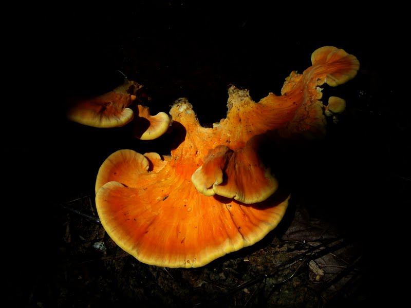
Shortly further upstream I found my crossing point. There is a small clearing here and a banking that climbs through some trees to an overgrown skid road. I taped the trees with pink tape up to the main trail/road. Along the way I found an orange mushroom that was glowing in the sunlight, it was amazing! This small starting point taped off it was now time to head through the woods onto the road. This is were I get a little skittish. I am fine solo hiking on trails and familiar mountains. But the idea of Moose and Bear that are plentiful on this property and me squeezing my way through dense forest and old skid roads (which are probably used as herd paths by these animals), makes me a little unsettled and jumpy. I know these animals are more scared of humans than we are of them and the chance of a bear attack is like zero, I still am very cautious and try to be as loud as I can!
So, I took a right on this road and followed it. Dragonfly's seem to love these semi-open old roads and I was chasing them around from tree branch to tree branch! A ways down the road became very overgrown with young pine trees. Then it abruptly ended. Dang! I found some animal bones in a pile here and I got a little squeamish! I believe I was right near the spot where I found a dead moose and I wondered why I was finding more bones. I followed the bones through the woods and came to the spine and jaw sitting next to each other. 30 feet away was the spot where I had found the dead moose and it was not there. So something dragged it through the woods and I guess was picking off what little, if any meat that was still on the bones. This freaked me out! Just then a very loud knocking made me jump and nearly have a heart-attack! I remember hearing this before and I believe it is a tree blowing in the wind. At any rate this particular spot gives me the creeps every time I'm here. It feels haunted and cursed or something. So I bolted outta there and across the river to the kiosk!
Safe and sound back at my truck I took a break and cleared my head. I wasn't giving up just yet. I walked up the road (Burrows Farm Trail) and followed my pink tape back up to the river. I then spotted a mushroom. It was nearly half-a-foot tall and in perfect condition! Nice! I continued on to the skid road. I went left this time and almost immediately came out onto Piper Mt. trail/road where it takes a sharp left and goes uphill. I new this spot was close to Burrows Farm trail but didn't realize it was THAT close! At this point I decided to just head down this trail to Bowser Pond and check things out down there. If I felt like it I could continue my woods exploration from above and maybe it would be easier to find my way down to the river.
I arrived at the Bowser Pond trail and headed down the banking where I had blazed a side path. I hung out on the pond shore and took some pictures and looked for birds or maybe a moose across the other side. All was quite...very quite! I made my way along the shoreline, stopping at various open areas where there were small rocks to sit on. The Pickerellweed was in full bloom and was very pretty up close. I am always surprised to not find any frogs or turtles laying in the sun on the logs over here. Perhaps they are in the pond, but I've yet to see any. I did find one little lonely frog on a rock though.
I found the duck decoy thingy Scott and I had spotted on our first visit here and I was going to take it with me and get rid of it. But I didn't want to carry it and didn't feel like it was doing any harm, so I placed it back in the water. I also spotted another out in the water along the marsh section. Bee's were busy collecting pollen from them and dragonfly's were whizzing by skimming the water. Such a beautiful relaxing area! I made my way to the Southern end of the pond where there is a small clearing which I believe is part of the pond floor when the water is high. This is a beautiful spot! Across the pond you can look up to MMR's East peaks and there are tons of dragonfly's.
I hung out here for a while before heading out. Just then I spotted this small, weird looking plant on a log at the shoreline. It was so weird looking! There were hair-like tendrils that came out from a succulent leaf that appeared to have drops of water on the tips of them. Very awesome! I did some research when I got home, Scott helping by saying it looked like a fly catcher. He was almost right! It is a Sundew. The droplets of water are actually a gluey substance it secretes to capture insects. One of New England's Carnivorous plants. What a great find! Very excited now, I headed up the road and back onto SPNHF property and Bowser Pond trail. I came to the top of the hill where I was hoping to bring the Bowser Pond trail into the woods.
I explored this area and actually found a herd path about 100 feet to yet another overgrown skid road. Perfect! I followed this shortly to the top of a steep drop over the banking. The woods here were open and the ridge was covered with boulders! I followed alongside the banking down to a gully of sorts and up to a good sized boulder on the top of a hill. What a great trail side feature! This route is great! The banking here was much less steep and provided the perfect spot for the trail to ascend/descend easily. So down I went and back into the trees. I reached the young Pine trees, which I now know is part of the old skid road I was on before. I found the road and was unsure if this is exactly where I wanted my trail to go.
Tired, hot and happy with my findings I called it a day. I just have to connect the dots now and find the best trail in the middle section. Then I can begin trimming and blazing! Should be pretty straight forward. Most of the trail will follow old skid roads! I plan on having this trail finished by the end of August! I can't wait! A direct route from Burrows Farm trail to Bowser Pond Trail will provide an easier hike to this beautiful spot and will provide a nice loop option using Piper Mt. trail :) Once this is complete I will be searching the woods off of North Trail to find the ledge that overlooks Bowser Pond!!
 |
| Mushrooms |
 |
| Amphibian Trap |
 |
| Mushroom |
 |
| Dragonfly |
 |
| Mushroom |
 |
| Pickerellweed |
 |
| Bowser Pond |
 |
| Sundew |
 |
| Boulder |
 |
| Boulder Field |
Friday, August 12, 2011
MMR "East Peak" 8/6/11
 |
| Rock on a Ledge & Pitch Pine |
Finally getting this report done! Scott and I were undecided on our Saturday hike. The weather was looking unsettled and Sunday looked crappy. We really wanted to climb Garfield and get Scott another peak caught up to me on the 4000 footer list. Also, a couple that are friends of ours was planning there final 48 on Mt. Isolation Saturday. We planned on joining them for a surprise show-up in the morning. Well, the morning came along and the weather report looked worst than the night before. We had done Isolation in the cloud cover before and really didn't want another no-view hike or getting caught in rain showers! So we stayed in our area and headed back to Moose Mountains....again!
 |
| Helliborine Orchid |
 |
| Phoebes Nable Mt. & Burrows Field |
 |
| Summit area of East Peak ? |
 |
| Green Frog |
 |
| Mushroom |
Friday, August 5, 2011
Phoebes Nable Mt. 8/4/11
"Off-Roadin' Stroller" (pictures)
Thursday I picked up my sister and her two daughters for a hike up Phoebes Nable at Moose Mountains Reservation in Middleton, NH. Me, Jill, Sarah (5) and Taylor (2months) arrived at the parking lot at noon time. As Jill got the baby ready in the jogging stroller I checked out the grown-in woods road that Scott and I are hoping to build a trail on. Right there was some sort of orchid-like flower growing. According to my research I think it might have been an Helliborine Orchid. It's amazing how many flowers are growing up here!
We applied bug spray as the overcast sky's were keeping the mosquito's out and the horsefly's were also on the attack! We made our way up Burrows Farm trail, Sarah asking a hundred questions and announcing every little thing she saw, and every time she would trip on something....kids, LOL! It was neat however to see her curiosity for mushrooms and once she saw me taking pictures of flowers and shrooms she was telling me to take pictures of everything. Guess I'll have to get her a little camera!
At one point she spotted some black-eyed Susan's and yanked one right out of the ground. We explained to her not to pick the flowers. It was very funny to find small shoe prints of another kid in the mud further up the trail, and a black-eyed Susan sitting nearby pulled up. All kids are alike I guess! We got a chuckle out of it. I also got a good laugh when she told me to take a picture of the "yellow flowers". Those being Goldenrod. I told her they were just a weed that make people sneeze. So for the rest of the day she would point them out and say they were "sneeze flowers". Too funny!
Well, we stopped at the Burrows cemetery for a break then headed up and across the field. From here Jill continued pushing the baby through the alternating terrain. I had to lift the stroller a couple times over rocky, steep sections. Did I mention the baby slept the ENTIRE time! Amazing!! We made the summit just after 1pm and took a nice long lunch break in some shade. Baby Taylor finally awoke and was just staring up to the sky. What was she staring at? There was a huge pine branch over head and she was just captured by it! Oh yes, she's gonna be a nature girl too!I chased a White Admiral Butterfly around for a few minutes much to the amusement of Sarah. Then we walked a little ways into the ledgy area to look for a hawk feather where I had found one before. Instead we found a huge orange mushroom cluster which was just as exciting!
Once we all ate and Taylor finished her bottle we made the trek back down. Along the way I spotted a tiny pink flower that I believe is Showy Tick Trefoil and also found Orange Jewelweed that was passing by. We stopped below the field where we had found a nice patch of wild black berries to snag a few more to eat. They were so good! Further down the trail was this big yellow dragonfly that literally stayed ahead of us and followed us for nearly half a mile. It was pretty neat! We made it back to the parking lot at about 2:15pm. A great hike with my sister and two of her three kiddo's. Maybe we'll have to head to Castle in the Clouds next week. Sarah wants to see some waterfalls! And Jill might have a baby back pack by then to carry Taylor in!
 |
| On the Summit of Phoebes Nable |
 |
| Sarah holding a Toad |
 |
| Sarah on Phoebes Nable Mt. Trail |
 |
| Sarah & Jill Climbing the trail |
 |
| Jill picking some Black Berries |
Sunday, July 31, 2011
Moose Mountains Trail Sign Work 7/31/11
"Erecting MMR's First Trail Signs!" (pictures)
On Thursday 7/29 Scott and I headed back to Concord to finish up the trail signs that were done the previous week. We arrived at the SPNHF head quarters and we got the MMR Kiosk sign completed and worked on the many others. We brought the signs for MMR home and finished those up that night. Friday we drove up to MMR and returned the beautifully refurbished kiosk sign. And boy did it look great!
The weekend rolled around and we decided we would head to the White Mountains Sunday to hike a 4000 footer. But by the end of the day we both didn't want to make the drive and we really wanted to get our posts and signs up to MMR and get them up! So excited the next morning we spent a couple hours putting the finishing touches on and getting the tools all together and loaded in the truck. We drove up the road stopping at the re-painted Hall Spring sign to put a larger bolt in it. I took a picture of an interesting plant (Wooly Snake-skin Plantain) that grows there that was flowering. It has neat green leaves with white veins and long slender flowers.
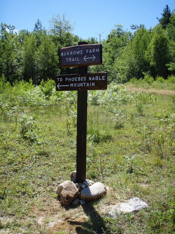
We continued the drive up to the "Stevens Cemetery Road" and trimmed some branches and put up a "trail" arrow. Then it was up to the Burrows Farm field. We parked and loaded up the sign for Phoebes Nable Mt. trail at a junction below the summit. We made the walk all the way up the hill to find that I had left the long bolts at home and brought the wrong ones up with me! So, bummed out we headed back down. Now it was time for some post hole digging! The new post digger the Forest Society lent us worked great. And thanks to the many years of this field being dug the were little rocks that stood in our way!
We had the first post and trail signs up really quick! We packed rocks and soil in around the post then decided to build a rock cairn around the post. It was an exciting accomplishment for us and we were thrilled to get the next one in! So we drove down to the river crossing and got the tools out. We noticed a truck parked on the landing up the road and wondered who it was and what they were up to.
This area proved to be a little more difficult. It was rocky and needed to be shoveled out. But again, between the two of us we went rather quick and got the post in. Another truck came up the road then and we chatted with the father and son briefly who was out just checking out the trails. Then a couple came down the road who turned out to be land owners of the property just above the field. We were glad to finally meet them and they were very nice and helpful and knowledgeable of the area. After a long chat they took off. We finished off the post with a cairn around it and sat and ate our lunch.
We then headed back down, made the 15 minute trip home. We decided to grab the long bolts and head back to put the Phoebes Nable Mt. trail sign up. We drove back and parked half-way up the road. We passed by our new signs and admired them with excitement and pride. We crossed the field and began the climb up the hill. We reached a couple hiking halfway up and chatted with them. The lady turned out to be a face book friend and was checking out the property she had been reading so much about. The two maintain a trail on the Ossipee range were eager to offer there help to us should we ever need it. How nice of them to offer! I'm sure we'll be calling on them at some point! We quickly attached the sign to the tree, admired our work and headed back down. Almost back at the truck we smelled an unusual smell. Not a terrible Moose smell but some sort of animal. Perhaps it was a bear! Not sure!
A rewarding day for us, beautiful weather and a job well done :o) We can't wait to get going on the rest of the signs and making more! We really want to find the trail to Moose Mountain and get started on blazing and signing that, then there's the North View trail, South View trail, Bowser Pond trail, Mountain Trail and so much more! We'll be at it for years no doubt! And we are loving every minute of it. Such a beautiful property with so much to offer!
 |
| Refurbished Kiosk Sign |
 |
| Snake-skin Plantain |
 |
| Breaking Ground for the First Post |
 |
| First Sign Post |
 |
| Second Sign Post |
 |
| Phoebes Nable Mt. Trail Sign |
 |
| End of the Day |
Saturday, July 23, 2011

Bowser Pond 7/18/11
"A weekday walk-around" (pictures)
 Just a quick walk today. I printed 2 maps to put in the mailbox. All five were gone after only 4 days! So I guess I'll have to print more off! We hiked up to the Burrows Cemetery to check on the lily's. A couple had flowered and it looked nice! Then we headed back down and up North Trail, took a right onto Piper Mt. Trail. We checked out Bowser Pond then continued down Piper Mt. trail as we hadn't been down past this point.
 On the left was a grown-in skid road. Scott wanted to check it out so we climbed the hill for a pretty good view across to the pond. We then snaked our way through the various grown-in roads to arrive back onto Piper Mt. Trail at the top of the hill. We made the walk back to the truck and called it a day.


Thursday, July 14, 2011
Burrows Cemetery Work, Burrows Farm & North Road 7/14/11
"A busy day at the MMR" (pictures)
I dug up some old fashioned lily's from an overflow garden of ours a few days ago and had them sitting in a 5 gallon pale. After spending two afternoons at the MMR I figured it wouldn't hurt to make another trip and get these lily's planted in front of the Burrows Cemetery. It was lacking color and was in need of some attention now that the overgrowth is all cleared away. So I packed up my truck and headed out. There was a car in the parking lot so I figured I would see another hiker today. I checked the map box to find another map had been taken. I drove up to where the seasonal river crosses the road and parked in my usual spot. The second I stepped out of my truck the horse/deerfly's were on me! Dozens of them ... "quiver". I carried the pale and shovel up the road ... a little heavy but not too bad. I cut across the Stevens Cemetery road stopping to spray myself down with bug spray as the horsefly's were REALLY getting on my nerves!! I climbed the hill and plopped my stuff down in front of the cemetery. I then proceeded to plant a group of lily's at each of the 4 posts.
It was then I spotted the hiker! She came up the road and asked if I was Jason? Her name rang a bell and turned out she was a facebook friend from the hiking community! We chatted a bit and she asked how to get to Phoebes Nable Mt. I pointed her in the right direction and off she went! The SPNHF sign workshop is this coming week on 7/19&20 and we hope to get some signs in place at the junctions to lessen the confusion! I returned to the cemetery and decided to haul some large stones over to cap off the inner lily's at the entrance. I enjoy landscaping and building rock walls and the stones I brought over fit perfectly together as if they were meant to be! After I got 4 stones down and tucked in I took a break and just relaxed. This is always such a relaxing, quite area. After my break I headed back down to the truck.
I then drove down to the North Road landing and parked. I threw my bag back on and was going to do a walk down to Bowser Pond to inspect my blazing from the previous day. Instead I spotted a beautiful Twelve-spotted Skimmer Dragonfly! I chased this guy around for nearly 10 minutes and he just would not let me get a picture! He finally perched way up on a twig from a tree that was hanging over a banking. I crawled underneath and got a picture of him from below.
At this point I scrapped my hike down to the pond and figured I would save it for when Scott got home from work, perhaps he would like to take a walk. So I picked up the beer cans and other trash lying around and put it in a pile for pick up at another time. I then began to hear voices and a rumbling noise. I thought perhaps it was ATV's but it turned out to be a helicopter passing over head. As I rounded the corner heading back down the voices were a father and his kids coming up the road. Another person who knew who I was! He said he took my last map and I pointed him down Bowser Pond Trail.
Back at my truck I ran into the lady I met earlier and another woman coming up the road with a young kid. She also knew who I was and was very thankful for the work we have been doing up here. She said she has been hiking the trails for 5 years and was excited to see the work being done and the information and reports online. So many people we've met these past couple weeks, all very happy with the work being done ... makes me all the more excited and determined to keep at it!
When Scott got home he said he was up for a walk. I printed off 5 more maps and off we went. Good thing it's close by for us with all the times I've been up there! We parked at the lot, put the maps in the box and battled the horsefly's along the road. Scott wanted to see the work I'd done at the cemetery so we passed the turn for the pond and headed up towards Burrows Farm. Mushrooms are coming out now much to our excitement! I love taking photo's of shrooms! We passed the lady I had talked to earlier with the child, whom was passed out on her back. Good job mom! It is always so nice to see parents bringing there kids hiking! It's how my parents raised us kids and it is a wonderful thing!
We arrived at the cemetery and then walked up to the farm site. Scott decided he wanted to do some exploring in the woods and we stumbled upon stone foundations! Awesome! I thought the farm was filled in, but turns out the foundations are hidden in the trees! We looked around at all the old rotted beams and broken bottles and metal. Scott also spotted an old Automobile cab frame back behind the foundations, cool! After our little exploration we headed back down, making a stop at the North Road landing to pick up the pile of trash and we scoured the area and picked up more. Back at the parking lot another car was parked with a man in it. He asked a couple questions then asked if we had passed a guy. Apparently we must have missed him when we were up on North Road. Another map was already taken so I am assuming the guy was doing a quick hike or something. That was it for the day. Hope to get back up there soon to do some more blazing! Nice meeting all of you on the trails!
 |
| Woods Road |
 |
| Burrows Cemetery |
 |
| Six-spotted Skimmer |
 |
| Helicopter |
 |
| Goldenrod Spider |
 |
| Mushroom |
 |
| Old Automobile Cab Frame |
Wednesday, July 13, 2011
Piper Mountain Trail & Bowser Pond Trail Blazing 7/13/11
"Two Hours of Time, One Mile of Yellow" (pictures)
After two days of humid weather it was a rather nice day Wednesday ... hot, but a nice breeze blowing. So I decided to head back to Moose Mountains Reservation to work on some more trail blazing. I decided on blazing the Piper Mt. Trail to Bowser Pond. I drove up past the kiosk, checked the new map box to find 2 more maps had been taken! Guess I better print some more up! I continued driving taking a right at the North Road junction and parking at the landing where Piper Trail enters on the right. After some thought on the trail names on the property I am thinking this trail should be called Piper Link Trail as it doesn't actually climb the mountain, rather it links over to Piper Mt. Road.
Anyhow I clipped some trees leaning over in front of the snow mobile trail information signage and began my first blaze at about 12:45pm. The sun was hot but the breeze kept things mostly comfortable. I was thinking about the SPNHF crew on Mt. Monadnock doing trail work the past few days in the horrible heat! I would have liked to join them but the drive is way to long, especially having to head right to work when I got back. Besides, I have plenty to still do here!
After finishing the first two blazes at the entrance point I noticed a dragonfly landing here-and-there on the tops of dried up flower stems. It was so beautiful! I kept trying to get close so I could get a macro shot of it but it just wouldn't sit still. I chased this guy (and it is red, so literally a guy!) around for 5 minutes thinking I was supposed to be blazing trails, not chasing bugs around with my camera! The dragonfly then hovered and circled around my head several times as if to say, "get lost! This is my territory!" My patience finally paid off though and I got a beautiful shot of this Calico Pennant :)
Then it was down the road spotting ahead for a good tree, cutting the brush back, and slapping on a blaze. This continued until I reached the banking high above Bowser Pond. From here there is a grown-in woods road on the right. I cut the overgrowth back just enough for a visible trail and continued my blazes about 100 feet. Here there is somewhat of a clearing down the banking to the pond that Scott and I had found before. I built a small cairn here with nearby rocks and decided to put my "Blue Moose Marker" here.
Then I trimmed the trees and blazed down to the waters edge. I was a little disappointed to not see any herons or ducks. Probably not a good time of day for them and perhaps the noise scared them away! The pond is pretty just-the-same with a few dots of yellow water lily buds on top of the water. I also spotted a couple turtles sun bathing on some logs further up along the shore. I stood here for a few minutes relaxing and scanning the pond. I watched as half-a-dozen swallows catching bugs swooped over the water. Then I climbed the banking, clearing the rotted logs and what-not from the foot path.
Indian Pipe is coming up and blooming right now, so I had to take a picture of one. It was so cute there next to the trail. And they are my mothers favorite. My mission half complete it was now time to blaze back to my starting position! It was getting hotter out and I was already getting a little exhausted, sticky and hot. And it was nearly all uphill going back. I spotted a very bright yellow Clouded Sulpher Butterfly and really wanted a picture of it! It was very quick and would not sit still for more than a second. It kept making it's way back down the trail. I was getting tired and was not about to go back the other way, so I gave up on this one. Better luck next time! I ended my day at 2:45. I have been surprised at just how long such a simple looking task can take ... A total of 1 mile of trail blazing in 2 hours! It is very rewarding and exciting though to be putting the first blazes on this property!
Updated MAP 7/13/11
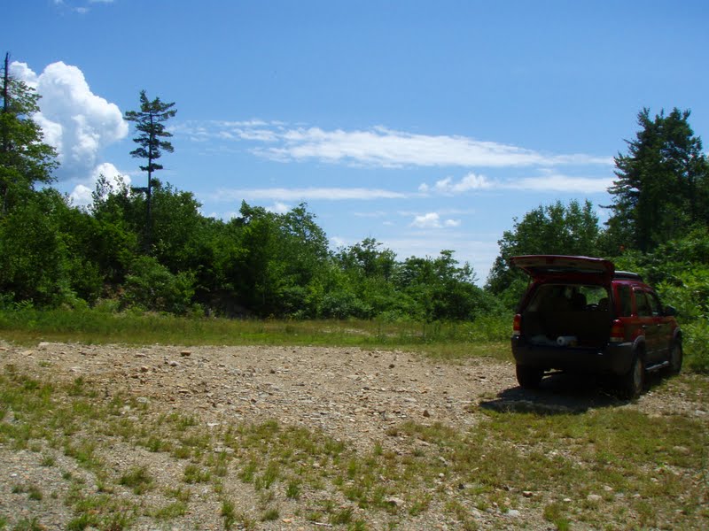 |
| Landing at North/Piper Mt. Roads |
 |
| First Piper Mt. Trail Blaze |
 |
| Calico Pennant |
 |
| Moose Marker & Blaze |
 |
| Bowser Pond |
 |
| Indian Pipe |
Updated MAP 7/13/11
Subscribe to:
Posts (Atom)